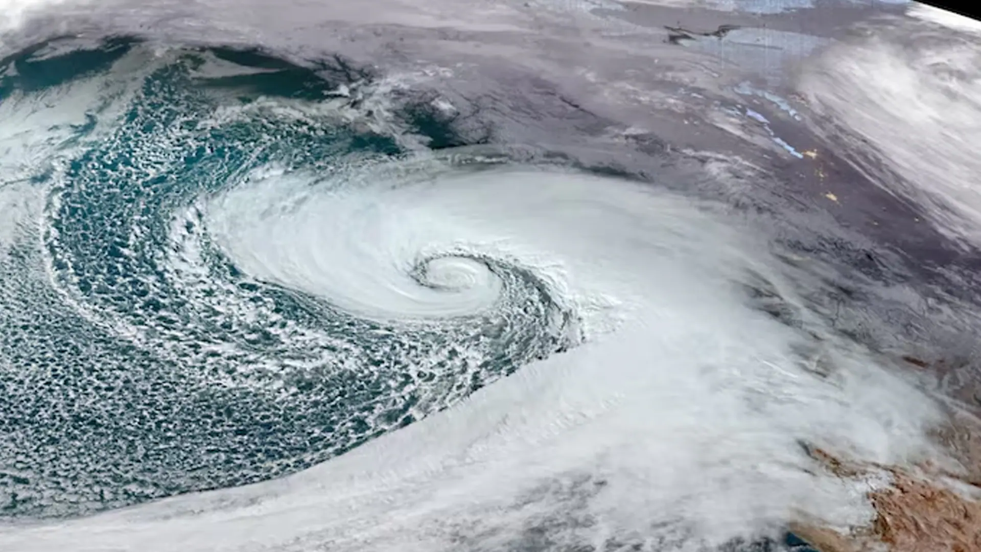
The term “bomb cyclone” has been making headlines in recent years, often evoking images of violent storms and catastrophic weather events. As winter storms intensify and become more unpredictable, the term has become synonymous with extreme weather, particularly along the East Coast of the United States. This season, meteorologists are closely monitoring the
development of a bomb cyclone that is poised to bring an atmospheric river of moisture and heavy snowfall to the eastern United States, threatening communities with intense weather conditions.
As scientists understand more about the complex atmospheric phenomena that contribute to such storms, the question arises: How does a bomb cyclone form, what is an atmospheric river, and what can the residents of the East Coast expect from this developing storm? In this article, we will delve into these questions and explore the potential impact of the approaching bomb cyclone.
What is a Bomb Cyclone?
A bomb cyclone, or
explosive cyclogenesis, occurs when a storm system rapidly intensifies. Specifically, it refers to a low-pressure system that drops at least 24 millibars (a unit of atmospheric pressure) in just 24 hours. This rapid pressure drop causes the storm to “bomb,” increasing the wind speed and the intensity of the precipitation associated with it. Bomb cyclones are typically associated with powerful winter storms and can bring hazardous conditions like snow, ice, high winds, and coastal flooding.
In the case of the East Coast storm, meteorologists are tracking a developing system that exhibits the characteristics of a bomb cyclone. As this system intensifies, the low-pressure area strengthens, pulling in warm, moist air from the Gulf of Mexico and colder air from the north, creating the perfect conditions for heavy snow, strong winds, and rain.
The Role of Atmospheric Rivers
Another critical component of the storm forming is the
atmospheric river, a narrow corridor of concentrated moisture in the atmosphere. These “rivers” of moisture can span thousands of miles and carry vast amounts of water vapor from tropical regions toward the poles. When this moisture-laden air reaches colder areas, it condenses, leading to intense precipitation — sometimes in the form of heavy rain, snow, or even flooding.
Atmospheric rivers have gained increased attention in recent years because of their ability to cause significant weather events. The combination of a bomb cyclone and an atmospheric river can lead to extreme conditions, with rain falling in the form of heavy snow in the Northeast, particularly in mountainous regions. This powerful combination is a major concern for the East Coast, especially when it’s combined with high winds and freezing temperatures.
Human Growth Hormone (HGH) has gained immense popularity among athletes and fitness enthusiasts due to its potential benefits in muscle growth, recovery, and overall performance. Many people look for
HGH for sale to enhance their training results, but it’s crucial to ensure you’re purchasing from a reliable source.
In the UK, the demand for HGH is also rising, with fitness-conscious individuals searching for
HGH for sale UK. However, buyers should always verify the quality and authenticity of the product before making a purchase.
How the Storm is Developing
Meteorologists have been keeping a close eye on a storm system developing off the coast, which is set to intensify and become a bomb cyclone. The atmosphere is ripe for this kind of rapid intensification, thanks to a combination of conditions:
- Moisture Supply: The storm is expected to tap into the atmospheric river extending from the Gulf of Mexico. This river will deliver copious amounts of moisture to the system, fueling the storm’s growth.
- Temperature Differences: As warm, moist air from the Gulf clashes with the colder air from the north, a sharp temperature contrast will aid in the development of the low-pressure system. This contrast creates the unstable conditions necessary for a bomb cyclone to form.
- Jet Stream Dynamics: The positioning of the jet stream is another critical factor in storm development. A sharp dip in the jet stream over the East Coast will allow the storm to tap into the cold air necessary to bring snow and ice while maintaining its strength. This kind of setup allows the low-pressure system to undergo rapid deepening.
Impacts of the Bomb Cyclone
As this bomb cyclone strengthens, it will bring a host of severe weather conditions to the eastern United States. Here’s what to expect as the storm unfolds:
1. Heavy Snowfall and Ice
The East Coast, especially parts of the Northeast and Appalachians, will likely experience heavy snowfall. Areas like New York, Pennsylvania, and even parts of the Mid-Atlantic could see significant snow accumulations. Additionally, there’s a risk of
ice storms in southern and central parts of the region. The combination of snow and ice could make travel treacherous, with roads becoming slick and hazardous, especially in the mountainous areas.
2. Coastal Flooding
As the bomb cyclone rapidly strengthens, it will also produce
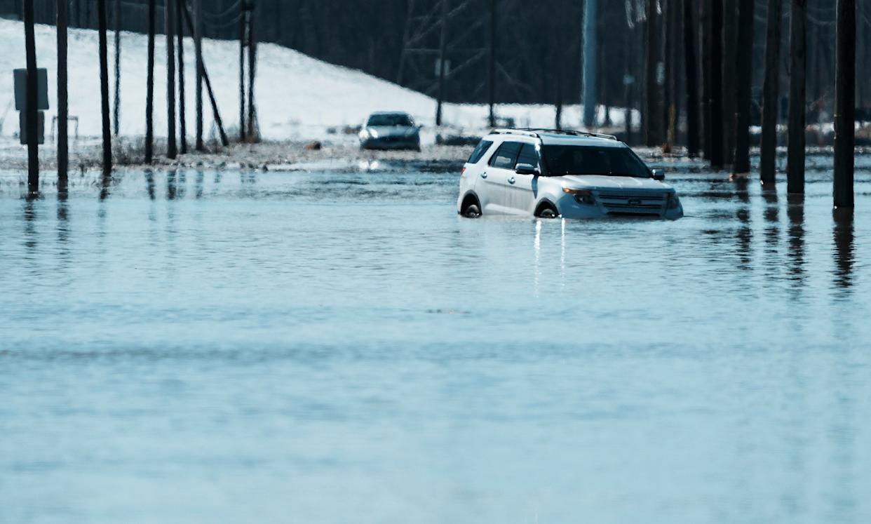
high winds and a storm surge along the coast. Coastal cities from the Carolinas to the Northeast could face significant flooding from the combined effects of storm surge and heavy rainfall. In addition to the coastal flood threat,
high tides could exacerbate the situation, leading to more severe flooding in vulnerable areas.
3. Power Outages
Heavy snow, ice, and high winds often lead to widespread power outages. The accumulation of snow and ice on trees and power lines can bring down branches or even entire trees, knocking out electricity in affected areas. High winds could compound this risk, making power restoration efforts more difficult.
4. High Winds
Wind gusts of up to 60-70 mph could accompany the storm, particularly in coastal regions and along the Appalachian Mountains. These winds are powerful enough to cause property damage, uproot trees, and contribute to the hazardous conditions on the roads.
Regional Impacts: Where Will the Storm Hit Hardest?
The storm’s track and development will determine exactly which regions experience the worst of the conditions. The East Coast is likely to see significant snow and rain, but certain areas are expected to be hit hardest.
Northeast (New York, New Jersey, and New England)
The Northeast will experience the heaviest snowfall, with the potential for accumulations of up to 12-18 inches in some areas. Coastal flooding is also a concern, especially along the Long Island and New Jersey coasts, where the combination of storm surge and heavy rain could overwhelm local flood defenses.
Mid-Atlantic (Washington D.C., Virginia, and the Carolinas)
Washington D.C. and nearby areas will likely see snow and ice. A significant ice storm is expected for parts of Virginia and North Carolina, which could disrupt transportation and power. Additionally, coastal areas in the Carolinas could experience flooding due to the storm surge.
Appalachian Mountains
The mountainous regions of the Appalachians will likely experience significant snowfall, with blizzard-like conditions in some places. These areas are especially vulnerable to icy conditions and snow accumulation, which could make travel extremely difficult.
How to Prepare for the Bomb Cyclone
As the bomb cyclone nears, it’s essential to prepare for the potentially hazardous conditions. Here are some safety tips:
- Stay Informed: Keep an eye on weather updates and advisories from the National Weather Service. If your area is under a winter storm warning or ice storm warning, take it seriously.
- Prepare for Power Outages: Stock up on essentials like bottled water, non-perishable food, flashlights, and batteries. Charge your phone and other electronic devices in case the power goes out.
- Travel with Caution: Avoid travel if possible, especially in areas prone to heavy snow and ice. If you must travel, ensure your vehicle is winter-ready, with snow tires and emergency supplies.
- Protect Property: Secure outdoor objects that could be blown away by high winds, and consider moving your vehicle to a garage or a safe location to prevent damage from falling trees or debris.
Conclusion
The developing bomb cyclone, combined with an atmospheric river of moisture, is set to bring potentially devastating conditions to the eastern United States. From heavy snow and ice to high winds and coastal flooding, residents across the region will need to prepare for a storm of significant magnitude. While the exact track and intensity of the storm remain uncertain, early indications suggest that this will be an event worth watching, and a reminder of the power of nature. As this storm develops, staying informed and taking the necessary precautions will be key to weathering the storm safely.
This Are Our New Website:


